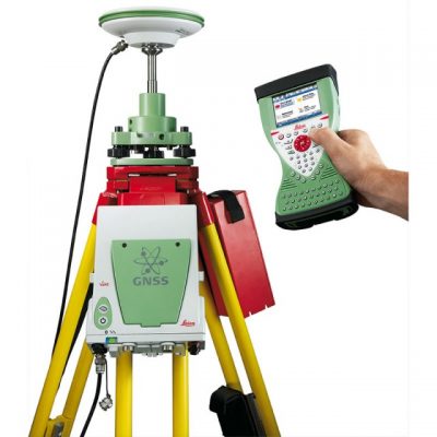
Leica GS18 I
Leica GS18 I GNSS RTK
-
- Measure points with obstructed view to the sky more efficiently and easily
- Capture points you couldn’t reach before with a GNSS rover
- Gain more flexibility and control, with no need to use additional time-consuming equipment
- Map hundreds of points with survey-grade accuracy within minutes
- Capture the scene quickly and decide later, what should be measured – even if the scene subsequently changes or disappears
- Tap on an image to measure a point in the field or in the office
- Quick and thorough so you catch every detail
Whole Country Shipping
Replacement Guarantee
Free Returns

WHY PURCHASE FROM US
- Quality Products & Services – We are committed to delivering reliable and high-quality solutions that meet industry standards.
- Experienced Team – Our skilled professionals have extensive experience and technical expertise in their respective fields.
- Customer-Focused Approach – We prioritize customer satisfaction and provide personalized support to meet specific requirements.
- Competitive Pricing – We offer the best value for your investment without compromising quality.
- Timely Delivery – We understand the importance of deadlines and ensure projects and orders are completed on time.
- After-Sales Support – Our relationship with customers continues after the sale, with dedicated technical and customer support.
- Trusted Partner – We strive to build long-term relationships based on trust, transparency, and mutual success.
Leica GS18 I GNSS RTK
Sensor fusion of GNSS, IMU and a camera come together to create Visual Positioning technology, resulting in a GNSS RTK rover so powerful that it enables you to measure what you see. GS18 I has all the functionality of the Leica GS18 T: in addition to Visual Positioning, users can for example map points with either tilted or levelled pole.
- Measure points with obstructed view to the sky more efficiently and easily
- Capture points you couldn’t reach before with a GNSS rover
- Gain more flexibility and control, with no need to use additional time-consuming equipment
- Map hundreds of points with survey-grade accuracy within minutes
- Capture the scene quickly and decide later, what should be measured – even if the scene subsequently changes or disappears
- Tap on an image to measure a point in the field or in the office
- Quick and thorough so you catch every detail
nnovative
GS18 I is an accurate and easy to use GNSS RTK Rover. It utilises highly innovative Visual Positioning technology based on seamless integration of GNSS, IMU, and a camera. It enables you to measure points in survey-grade accuracy from images either in the field or in the office. Alternatively, create point clouds from captured images using Leica Infinity to expand possibilities even further.
Fast
Designed to measure a large number of points efficiently. The GS18 I allows you to capture images and measure hundreds of points within minutes with no need to physically reach the point. Time spent on-site is reduced and revisits minimised - once the site is captured, you can measure all detail whenever you want to.
Versatile
Imaging power has changed the rules of the game. By having the power to measure what you see, you can now reach places you couldn’t before without the need to switch tools or climb through obstacles. This gives you flexibility in the field, frees up equipment and crews, truly maximises productivity, and increasing profits.